
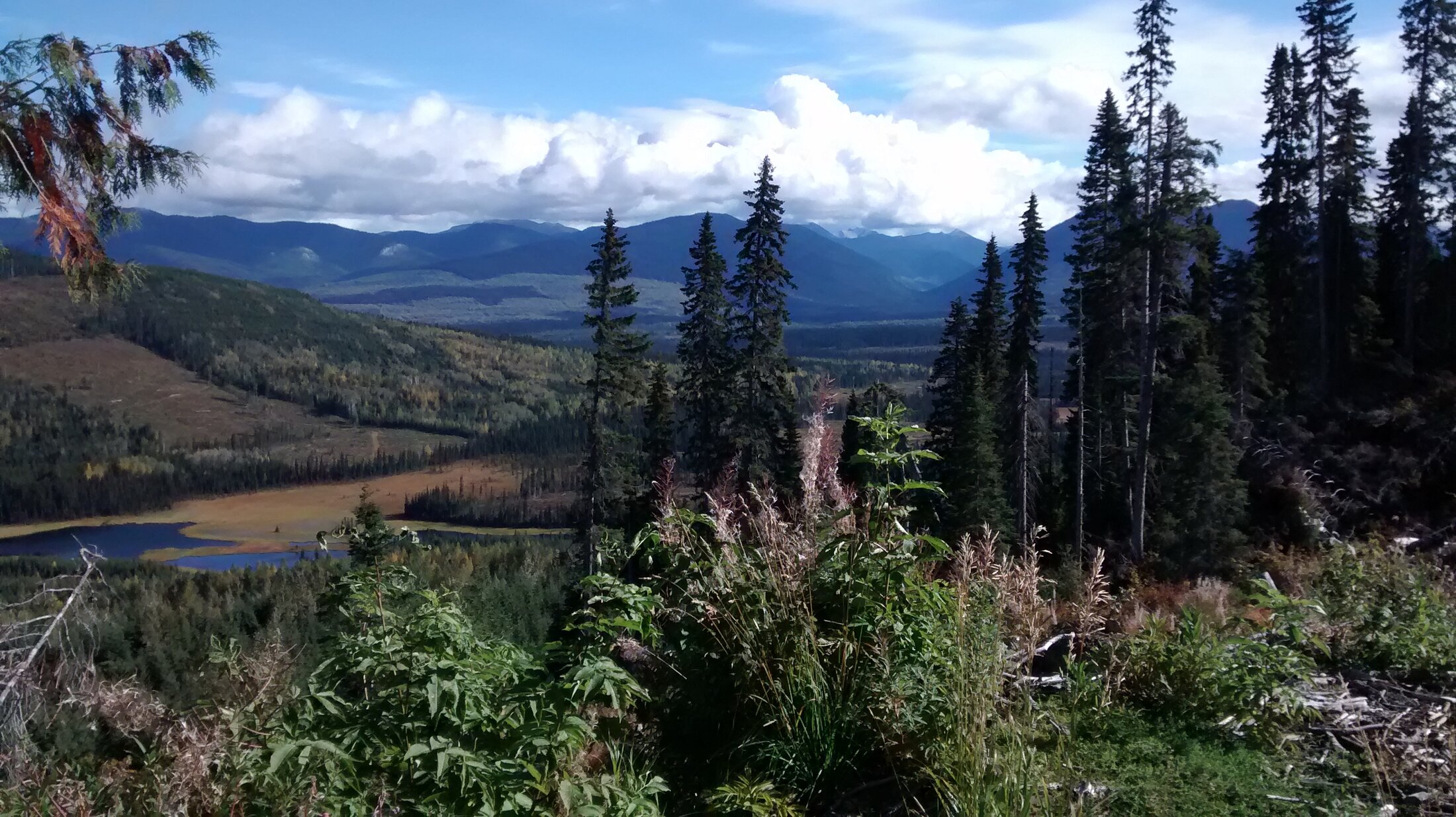
CR
Road-accessible, early-stage Wells–Barkerville claims with documented quartz–iron-carbonate alteration and massive-sulphide float.
- Location
- Wells–Barkerville, BC · Cariboo Region
- Commodities
- Cu · Au
- Project Type
- Besshi-type VMS (early-stage)
- Stage
- Early-Stage Exploration
- Land Position
- 2,667 ha
- Ownership
- 100% Eastfield-owned
Exploration LifecycleCurrent classification · Reconnaissance
- Generative
- Reconnaissance
- Target Definition
- Drill Ready
- Partner Drilling
Project Overview
The 2,667-hectare CR property lies approximately 20 kilometres north of Wells and Barkerville in the Cariboo Region of British Columbia. Historical exploration in the area focused on Besshi-type volcanogenic massive sulphide deposits. Completed work recorded in Eastfield's March 24, 2026 formal disclosure includes rock and soil sampling, 4.8 kilometres of induced polarization and one 206-metre diamond drill hole. The property is 100% owned by Eastfield Resources; no option or joint-venture agreement is in place. No current exploration or drilling program is stated here.
Geology & Target Model
The property lies within the Mississippian to Permian Slide Mountain Terrane, structurally underlain by Upper Proterozoic–Paleozoic Barkerville Group meta-sediments. Historical exploration in the area focused on Besshi-type volcanogenic massive sulphide deposits. Quartz–iron-carbonate alteration, associated base-metal sulphides and occurrences of massive sulphide float have been reported. Historical district records cited for regional context report approximately 4 million ounces of placer and approximately 1.2 million ounces of lode gold production in the Wells–Barkerville district; those regional figures do not establish mineralization or economic potential on the CR claims.
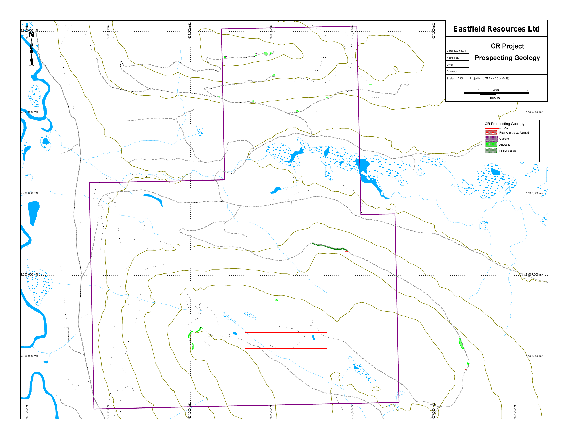
Technical Summary
A factual summary of property scale, completed work, documented observations and current ownership or transaction status.
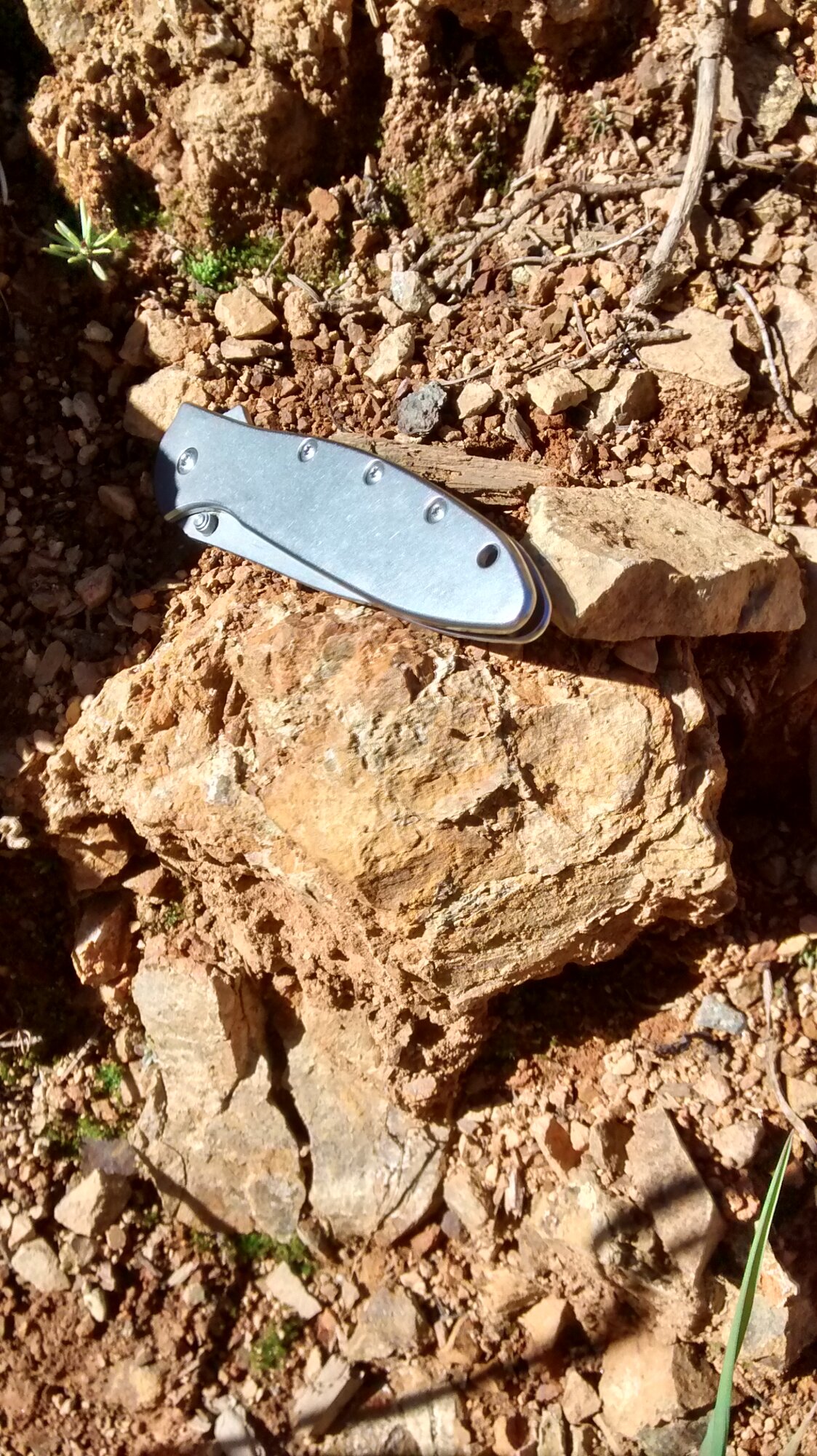
Well-mineralized massive sulphide float · quartz–iron-carbonate alteration
206 metres completed
200 m × 800 m chargeability anomaly · open north
1,864 ppm arsenic
Wells–Barkerville · historic Cariboo gold district
Exploration Highlights
- 01
Completed work recorded in Eastfield's March 24, 2026 formal disclosure includes rock and soil sampling, 4.8 kilometres of induced polarization and one 206-metre diamond drill hole.
- 02
A 200-metre by 800-metre induced-polarization chargeability anomaly remains open to the north.
- 03
Rock sampling along a logging road returned up to 1,354 ppb gold and 1,864 ppm arsenic.
- 04
The property is 100% owned by Eastfield Resources; no option or joint-venture agreement is in place.
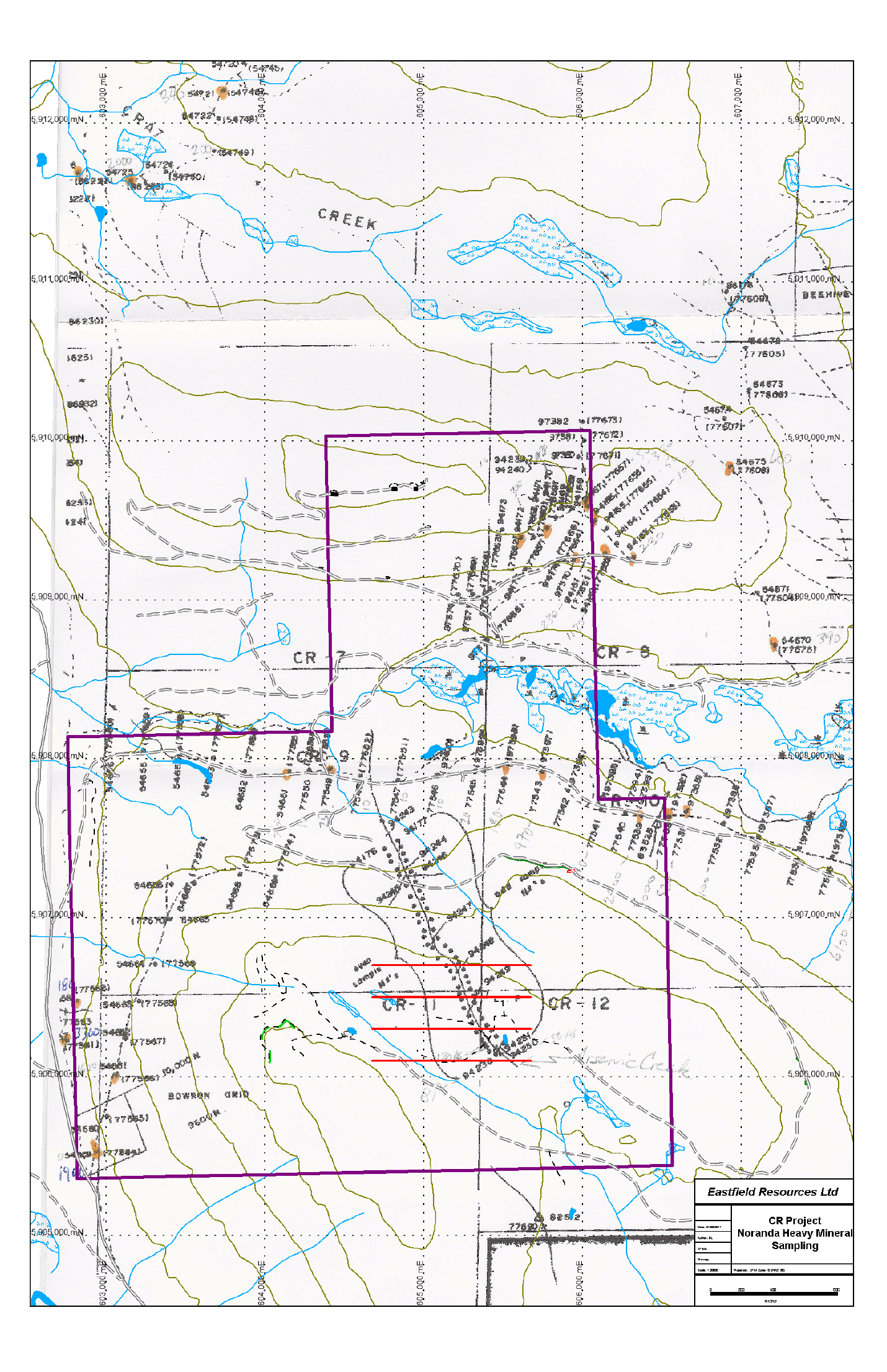
Maps, Figures & Camp
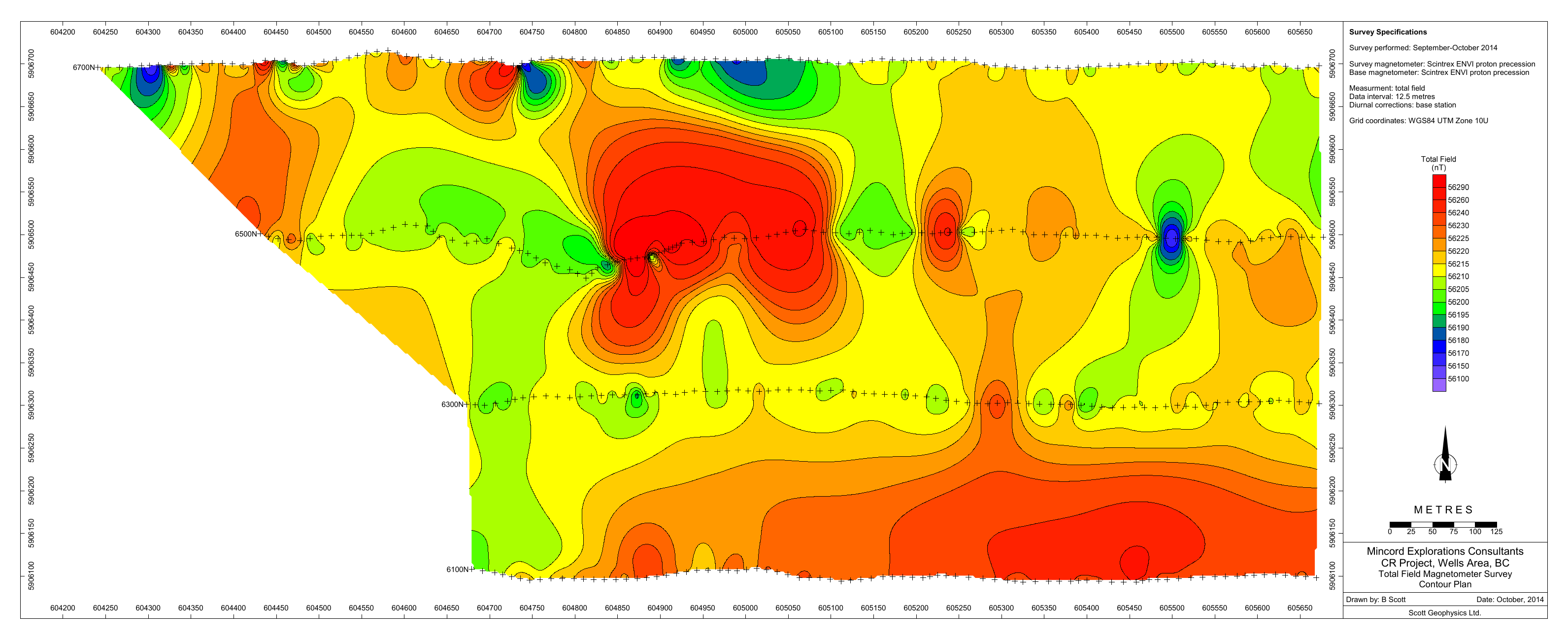
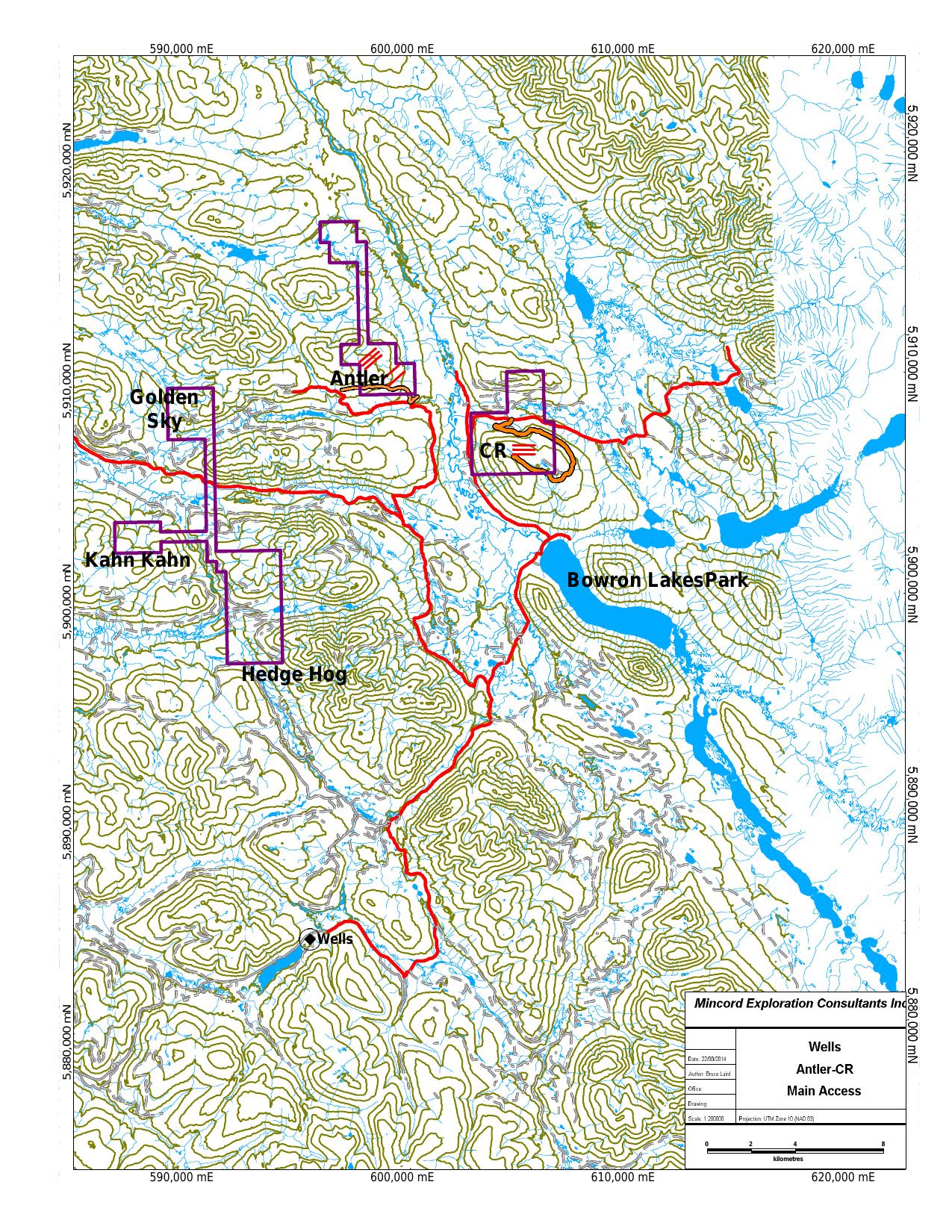
Ownership, Partner Status & Current Status
Ownership & Option Status
The CR property is 100% owned by Eastfield Resources. No option, joint-venture, or earn-in agreement is in place.
Current Status
The latest formal update records completed historical work but does not announce a current exploration or drilling program. Any future work would require current formal disclosure and applicable technical review.
Technical Disclosure — National Instrument 43-101
Qualified Persons (NI 43-101): Quantitative scientific and technical information presented on Eastfield’s current project pages has been reviewed and approved for website disclosure by William (Bill) Morton, P.Geo., President and Chief Executive Officer, and Glen Garratt, P.Geo., Vice President, Exploration, each a Qualified Person as defined by National Instrument 43-101 — Standards of Disclosure for Mineral Projects. Historical and third-party information should be read with the cited source, date and applicable qualifications. Eastfield’s continuous-disclosure filings on SEDAR+ remain the authoritative record.
Project History & Timeline
- HistoricalCariboo gold district
The property lies in the Wells–Barkerville area, a district with a long history of placer and lode gold production.
- 2013–2014Property staked
Eastfield stakes the road-accessible CR claims — held together with the neighbouring Hedge Hog property — in the Wells–Barkerville area.
- 2022Diamond drilling announced
Eastfield announced a drilling program in October 2022. The March 24, 2026 formal update records one diamond drill hole totalling 206 metres.
Exploration Programs
Diamond drilling
CompletedOne diamond drill hole totalling 206 metres is recorded in Eastfield's March 24, 2026 formal update.
Technical Reports & Disclosure
Public
Public records of historic Cariboo placer and lode gold production. Historical and not verified by Eastfield's QP.
Formal NI 43-101 technical reports, when filed, are available under the Company's profile on SEDAR+. Documents listed above include historical, third-party, and internal materials that have not been verified by Eastfield's Qualified Person.
Frequently Asked Questions
Who owns the CR property?
The CR property is 100% owned by Eastfield Resources. No option or joint-venture agreement is in place.
Is a current exploration program announced?
No. The Current Status section records no announced program. Any future work would require current formal disclosure and applicable technical review.
What evidence supports the target model?
Historical exploration in the area focused on Besshi-type volcanogenic massive sulphide deposits. Quartz–iron-carbonate alteration, associated base-metal sulphides and occurrences of massive sulphide float have been reported.
Related Knowledge & Resources
Knowledge Centre
Glossary Terms
Formal NI 43-101 technical reports for Eastfield's properties are filed under the Company's profile on SEDAR+.
Open SEDAR+ Profile